Snapzu Politics
Friday, 20 October 2017
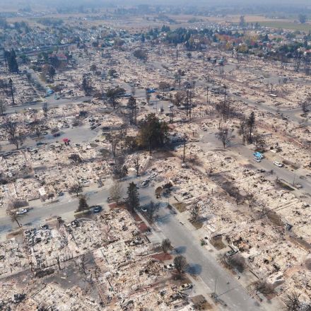
These 360° Drone Maps of California’s Wildfire Damage Are Horrifying
10,000 photos of a charred neighborhood, stitched together. By Samantha Cole.
Read more:
https://motherboard.vice.com/en_us/article/qv3dad/360-drone-maps-california-wildfires?source=Snapzu
No comments:
Post a Comment
Newer Post
Older Post
Home
Subscribe to:
Post Comments (Atom)
No comments:
Post a Comment